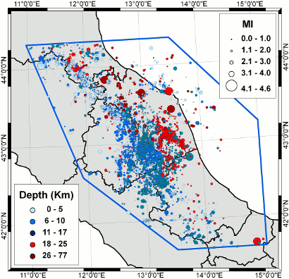
 The catalogue contains 15598 events localized with the procedures described in the following pages in the geographic area shown in the left-hand figure.
 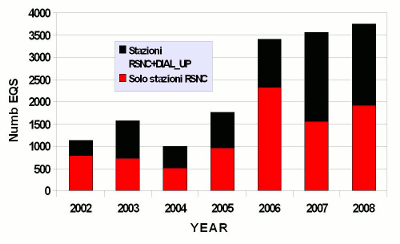 The right-hand figure also shows that about 50% of the used data were recorded only by the stations of the Seismic National Network.This can be due to the fact that the regional stations work in dial_up modality, with a network triggerthat varies from one network to another and that is less sensitive than those used by the Seismic National Network.